

 Lisa De Vellis, PE
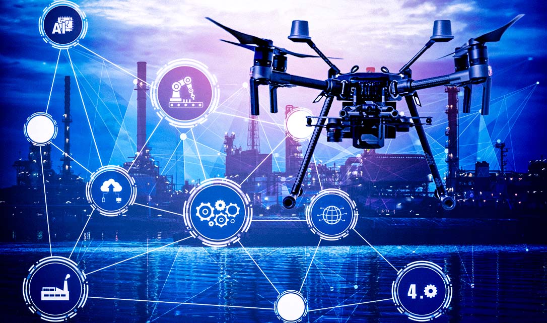
Digital Completions in Plant Modifications and Upgrades
Unlike greenfield or any new build construction projects, plant modifications and upgrades present a unique set of challenges. Work is carried out...
“Mirror, mirror on the wall, show me the latest as-built of them all.”
Could you imagine a magic mirror through which, at the snap of your fingers, you could see the real-time status and progression of your construction project?
It may sound like fantasy, but surveying drones – in coordination with other imaging devices and with specialist software – will do just that.
Those in the energy sector tend to associate drones with the use case of asset inspections, like of vertical infrastructure including offshore oil platforms or wind turbines, and of confined spaces.
But it’s the vastly underutilized and under-discussed use in remote construction management that’s poised to be a future trend. It’s the ideal application that allows for seamless navigation of the complexities inherent in industrial construction projects.
Drones enable construction management efficiencies by capturing data. While drones can collect many different types of data depending on the attachment(s) with which they are outfitted, they are only one vehicle through which to capture data.
Given the complexity of engineering industrial (and civil) infrastructure, the power of aerial drone data is most effective when combined with any of the other below on-the-ground data capture methods:
One independent research firm defines industrial-purpose drones as follows:
Multi-rotor and fixed-wing unmanned aerial vehicles designed to carry a payload of information collection technology with navigation and control systems that permit remote and autonomous flight within and beyond the line of sight.
The five overarching uses of industrial drones are inspections, surveying, monitoring, photography and films, and emergency response. Otherwise called Unmanned Aircraft Systems (UAS), drones in the energy sector offer a myriad of high-resolution data solutions for such things as:
Flight paths of industrial drones are programmed and pre-set. To record accurate progress from one interval to another when used for construction management, the drone would fly that exact same pre-programmed flight path every time at specified time intervals.
Industrial drone surveying could, in theory, be done completely remotely. In practice, however, a team of at least two would need to be onsite in order to facilitate the operation, including lift and landing. With training specific to the particular make and model of the drone, these drone operators understand the flight path and are acutely aware of any onsite risks.
Now, let’s get our heads out of the clouds and discuss how drones can keep your construction project above water.
Drones are essentially flying data loggers. Industrial drones could be equipped with a host of useful attachments that capture different data in different ways.
From 360-degree cameras to gas sensors and more, the uses of industrial drones are wide-ranging. For construction site aerial surveying, a camera equipped with LiDAR (Light Detection and Ranging) collects scanned point-cloud data.
A remote-sensing system, LiDAR computes distances to surfaces below, mapping its structure and density. It is geo-located data. This point-cloud data forms a visual representation of the topography under analysis – in the case of construction management, the facility over which the drone flies.
Assuming Wi-Fi is present, the drone automatically uploads the collected data (in this case, the point-cloud) to cloud storage. In the absence of Wi-Fi for particularly remote or under-developed contexts, operators can manually upload the data after the drone has completed its flyover. Software, like MODS Reality, then stitches that raw data into a data mesh.
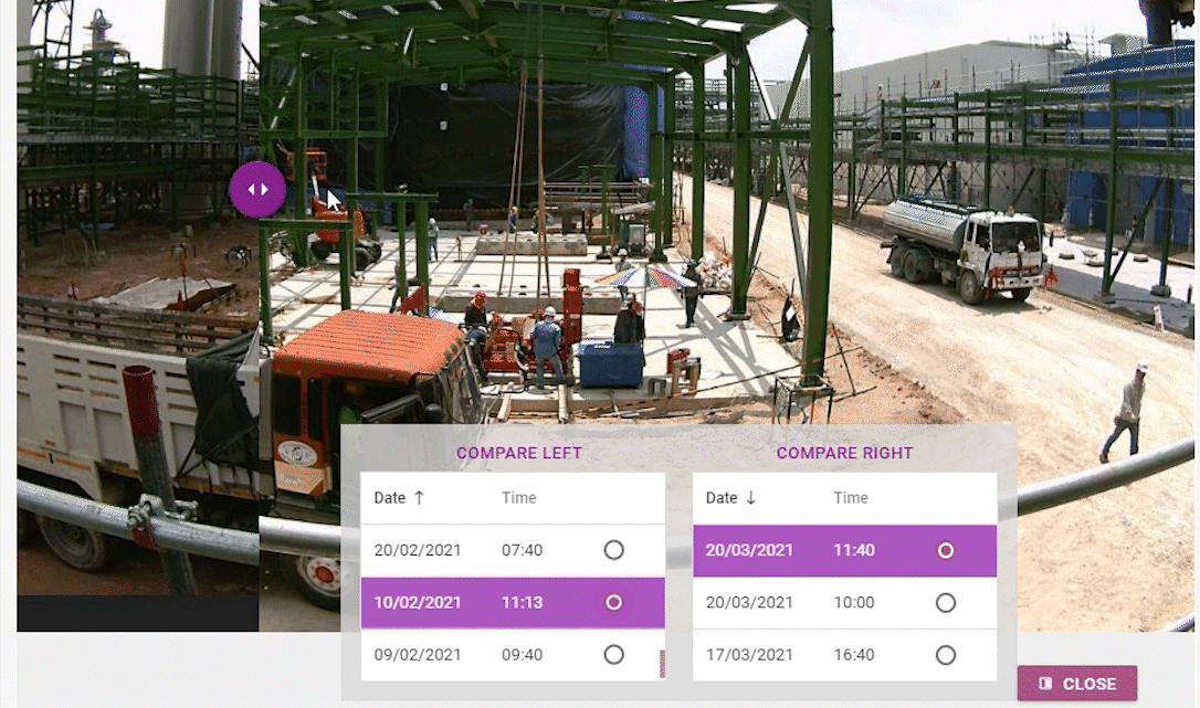
Point-cloud and mesh data may sound like abstract or techie concepts. Still, this high-density drone – accurate to within five millimeter – enables specialist software to output navigable data-laden as-built models.
As-built imagery from drones can be used to understand and both communicate construction progress and conformity with the 3D design model.
Specialized construction management software starts with a 3D model based on infrastructure and system design: 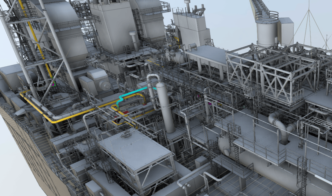
The data mesh can be overlaid onto the 3D design model: 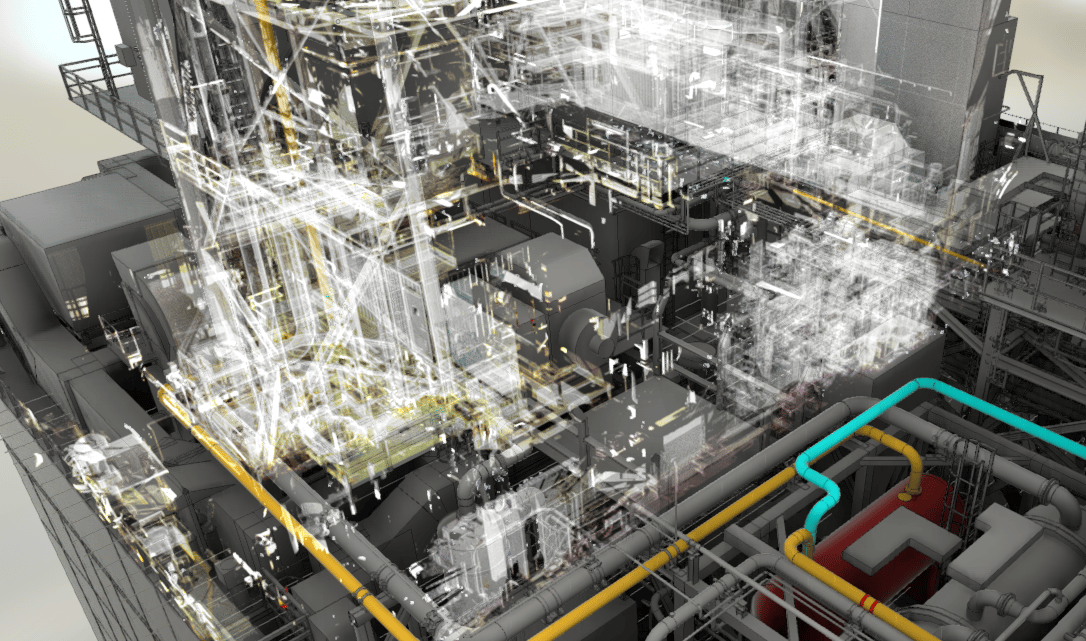
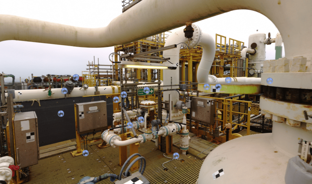
When used in conjunction with other data capture devices, the remote user can take it a step further by zooming into sections of interest, viewing on-the-ground infrastructure imagery:
For example, the visual as-builts can be designed via sophisticated software solutions to contain component specification and scheduling data. It gets even cooler. Specialized software enables a “compare” function, allowing for remote, visual progress reports:
Construction-sector drone use has been and will continue to be on the rise.
In 2017 the US industrial drone market was valued at 455 million USD, expected to reach revenues of 3.6 billion USD in 2030 and 6.1 billion USD in 2037.
Site and volumetric surveys – like the ones used for construction management – were the second most significant use in 2017, totaling 82 million USD in revenues. Site and volumetric surveys accounted for nearly a third of the European market in the same period.
Some drone usage scenarios, including surveying and mapping of geographically spread-out assets, are expected to lose momentum during the mentioned forecast period. In the US, this is due to things like Air Traffic Management regulations, public concerns revolving around privacy and safety, incongruous inter-State regulations, etc. The degree to which this may impact industrial campus development remains to be seen.
It’s impossible to see into the future. But when utilizing drone technology in construction management, the trauma of as-built conversations disappear. The ability to visualize status, anticipate delays and troubleshoot problems in advance makes the future of project management work a heck of a lot easier.
It’s like having a magic mirror, but better because you’re in control.
To learn more about how MODS uses drone footage to help with remote management of large sites, visit  .
.
Unlike greenfield or any new build construction projects, plant modifications and upgrades present a unique set of challenges. Work is carried out...
Turnarounds and shutdowns are among the most critical—and stressful—phases in the management and operation of industrial assets. These planned...

Offshore decommissioning and asset retirement present significant logistical, regulatory, safety, fiscal and reputational challenges. The process of...
This blog is the third in a four-part series looking at the following energy-sector development trends:

"Insufficient facts always invite danger.” – Dr. Spock

Following socio-political pressures towards net zero, the war in Ukraine has compounded the direct need to advance energy development. EPC...